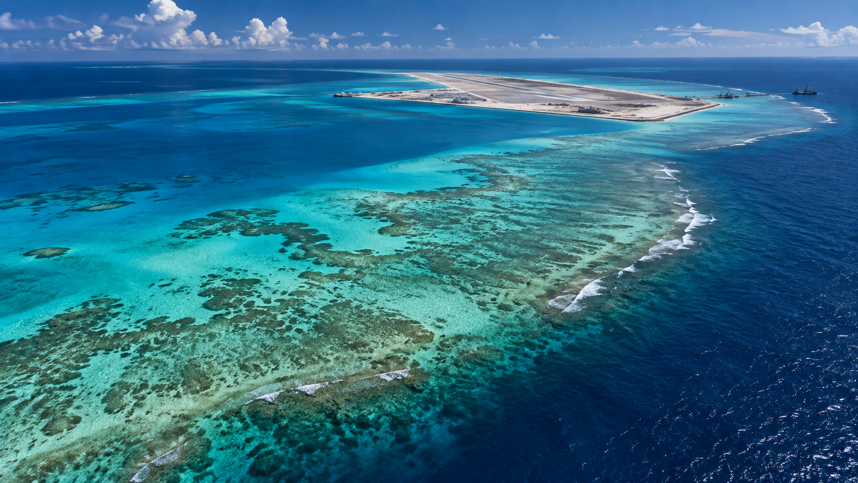
Barque Canada Reef: Mapping Rapid Land Reclamation
Satellite Imagery • QGIS • Remote Sensing • Spatial Analysis
project uses historical and current imagery to document the transformation of Barque Canada Reef from a largely submerged reef system into a substantially reclaimed artificial island.
Study Area: Barque Canada Reef
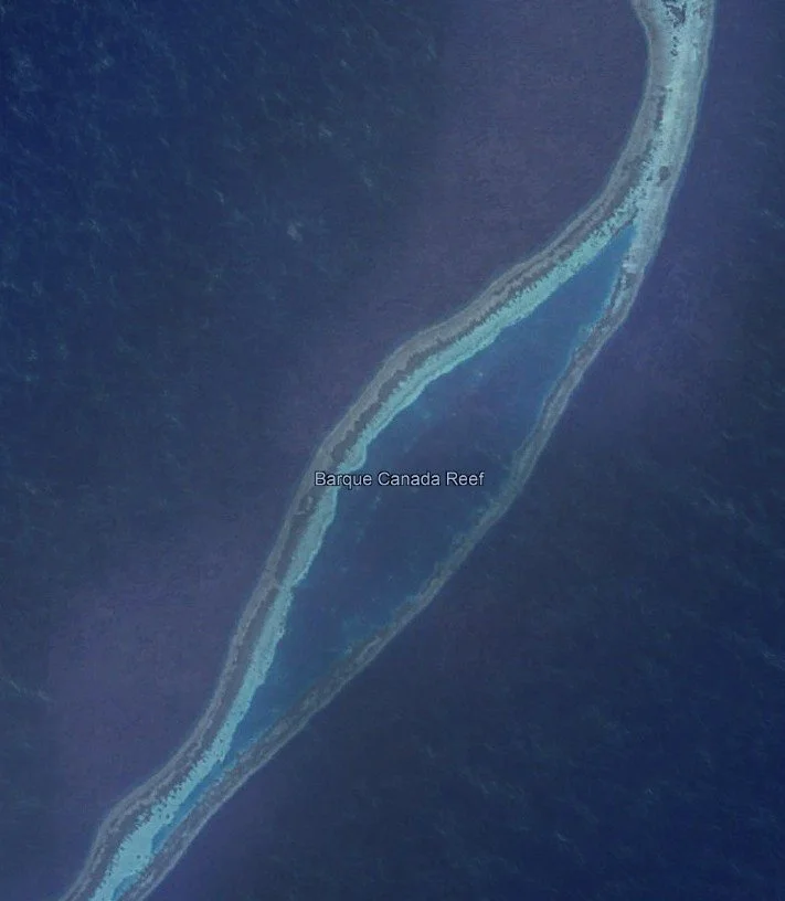
Before Reclamation
Source: Google Earth Pro, historical imagery (2020).
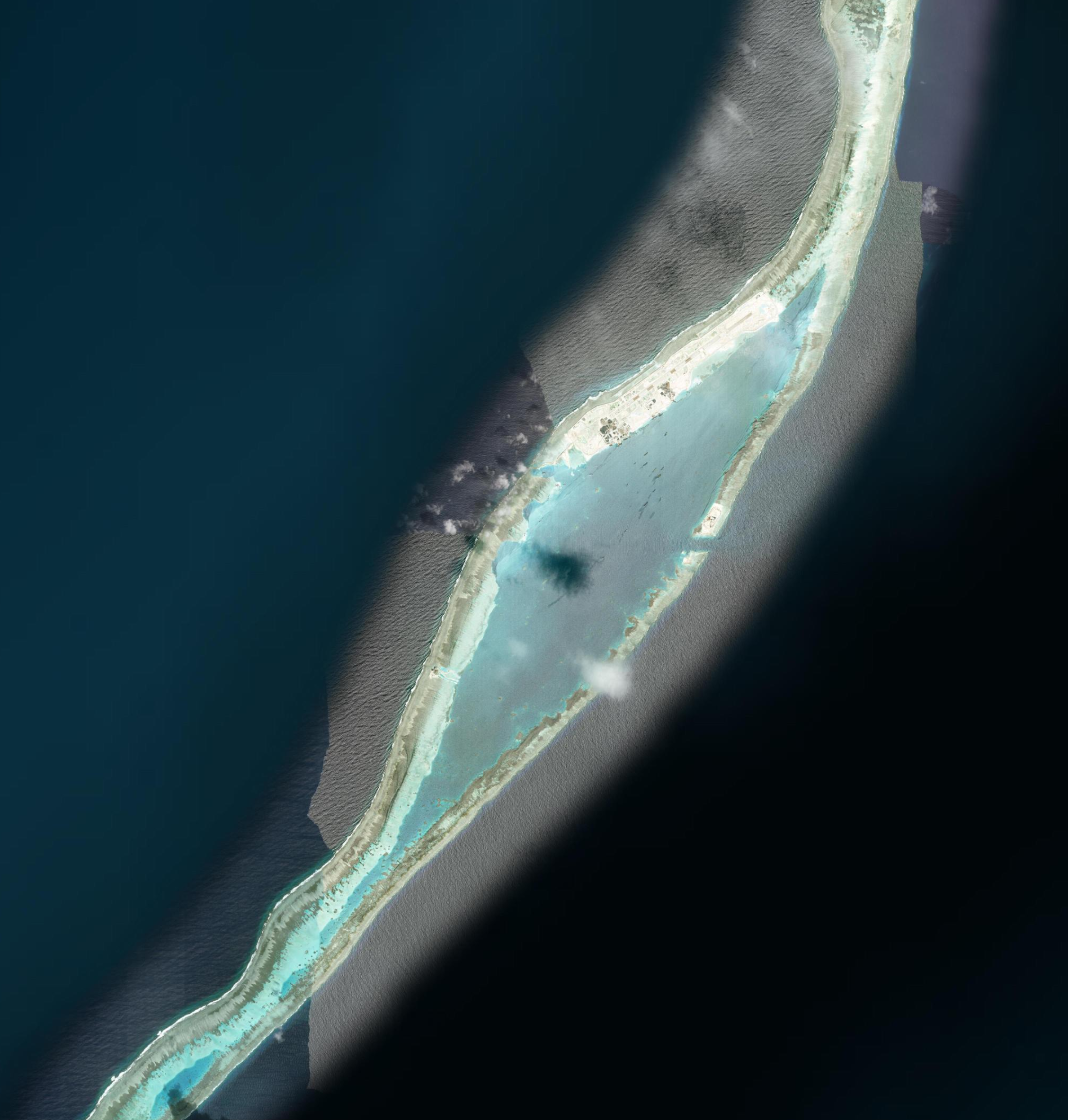
Current
Esri World Imagery — current imagery accessed 2026
The 2020 imagery provides a useful baseline just before Barque Canada Reef underwent its major transformation. At this stage, the reef remained largely defined by its natural shallow-water structure, with only small existing outposts visible and none of the extensive artificial landmass seen today. Large-scale modification began the following year, when Vietnam dredged a channel through the southeastern portion of the reef in November 2021. Land reclamation followed in 2022 and accelerated rapidly during 2023 and 2024.
Google Earth Pro provided historical imagery of Barque Canada Reef through 2020, but did not provide a sufficiently recent view of the site's rapid redevelopment. For the modern comparison, Esri World Imagery was therefore used to visualize the substantially altered reef. The newer imagery reveals a continuous artificial landmass created through extensive dredging and reclamation, replacing much of the shallow-water landscape visible in the 2020 image.
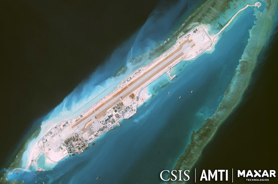
Since reclamation accelerated, Barque Canada Reef has developed into one of Vietnam's largest outposts in the Spratly Islands. Construction has included a major airfield, dredged harbor facilities, defensive infrastructure, and additional support facilities. By October 2024, approximately 8,000 feet of runway was being prepared, with the artificial landmass itself extending more than 14,000 feet—leaving room for further runway expansion. More recent satellite imagery also shows continued specialized infrastructure development, including construction of a DVOR aviation navigation beacon in 2026.
Runway and Infrastructure Development
A closer view reveals the scale of the newly constructed airfield and supporting infrastructure across the reclaimed landmass. The runway, buildings, access routes, and developed shoreline illustrate how dramatically the physical character and use of the reef have changed since the 2020 baseline.
Mapping the Change in QGIS
Satellite imagery → identify altered areas → digitize polygons → separate reclaimed land and dredged channel → calculate geometry → create final map
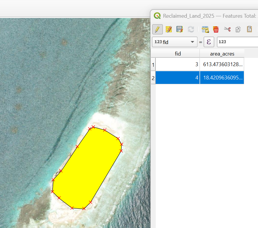
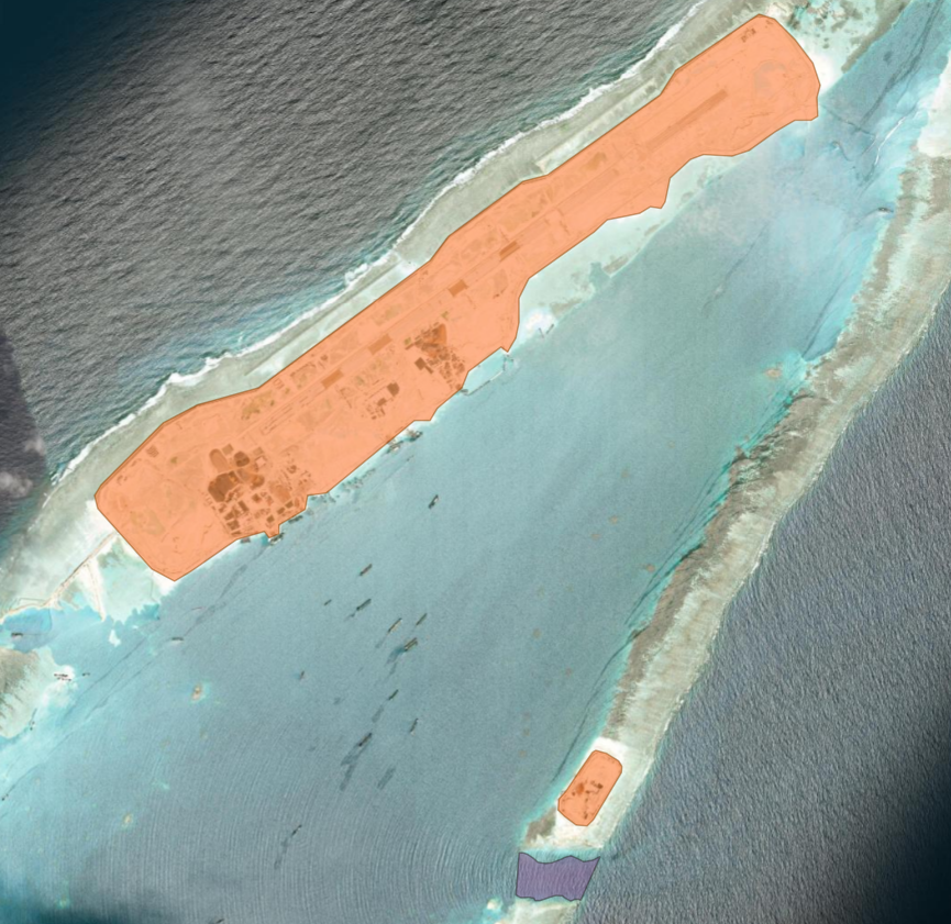
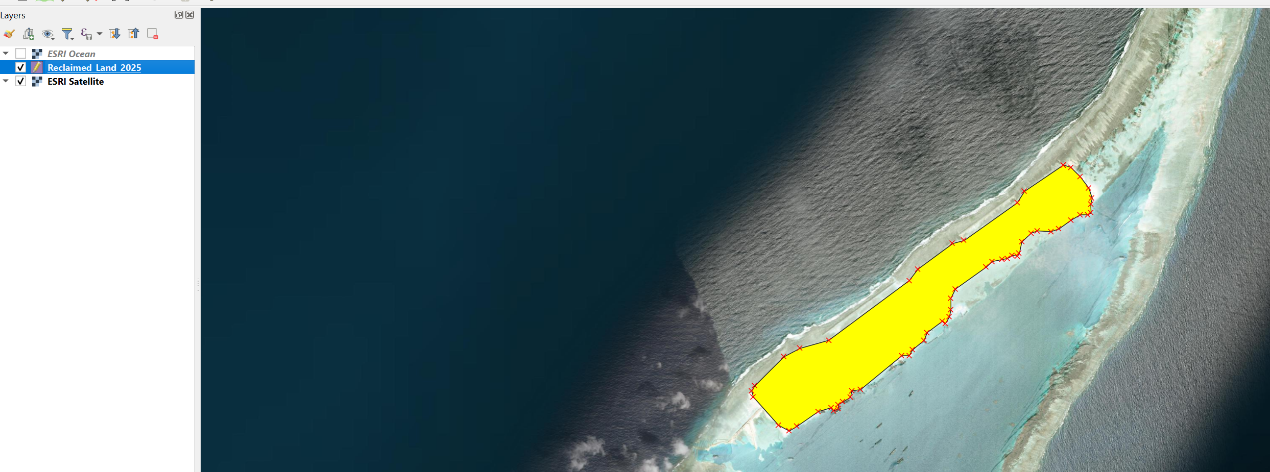
Reclaimed_Land_2025 — 2 polygons
Dredged_Channel — 1 polygon
CRS: EPSG:4326
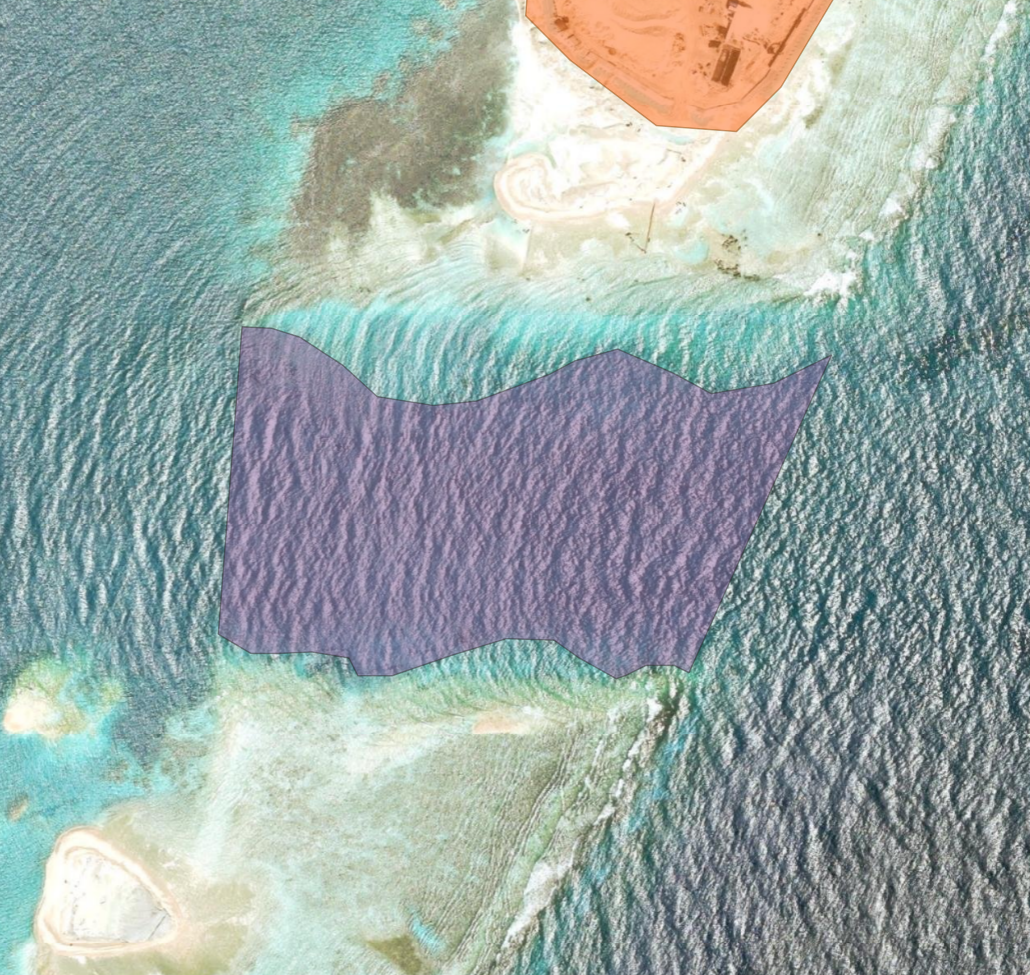
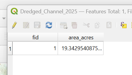
The dredged channel was manually digitized in QGIS using current satellite imagery. The mapped polygon covers approximately 19.3 acres, providing a quantitative estimate of the area represented by the visible channel modification.
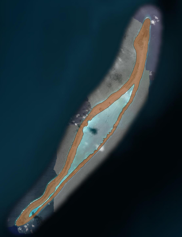
Island-Scale Context
To place the reclamation measurements in context, the entire current island footprint was independently digitized in QGIS. Interior lagoon and water areas were excluded using polygon rings, producing an estimated 7,806.03 acres of current dry-land surface area.
~8.1%
of the current mapped island footprint corresponds to the two digitized reclamation areas
The two reclamation polygons total 631.89 acres, or approximately 8.1% of the island's current mapped surface area. Approximately 7,174.14 acres fall outside those two mapped reclamation footprints.
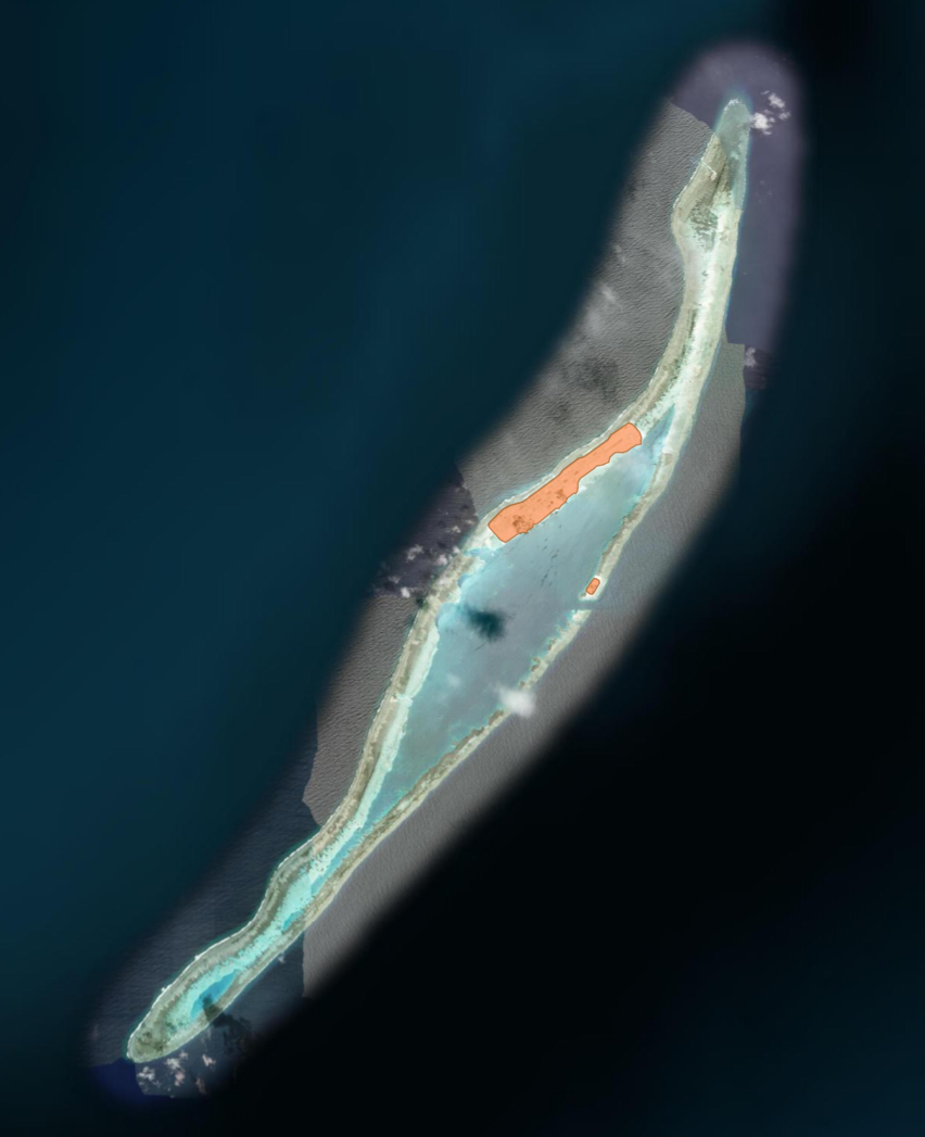
Results & Spatial Analysis
Digitizing the visible changes at Barque Canada Reef produced three polygon measurements representing two distinct forms of physical modification. The primary reclaimed footprint measured 613.47 acres, while a secondary reclaimed area added 18.42 acres, producing a total digitized reclaimed footprint of approximately 631.89 acres. A separate 19.34-acre surface footprint was mapped for visible dredging and reef modification.
631.89 acres
Total digitized reclaimed land
19.34 acres
Approximate surface footprint of visible dredging / reef modification
The reclaimed land and dredged channel were intentionally mapped as separate feature layers because they represent fundamentally different physical changes to the reef. Reclaimed_Land_2025 identifies areas where reef or shallow water was converted into new artificial land, while Dredged_Channel_2025 represents an approximately 19.34-acre surface footprint of visible dredging and reef modification.
The channel was excavated below the water surface to accommodate vessel access; however, satellite imagery alone cannot determine the depth of excavation or total volume of reef and seabed material removed. The 19.34-acre measurement therefore represents horizontal surface area only, not the full three-dimensional extent of dredging.
Keeping these features separate prevents the dredged area from being incorrectly counted as reclaimed land. The reclaimed polygons represent new artificial land, while the dredged-channel polygon represents visible modification of reef and seabed that remains a water passage. Separating these features preserves the physical meaning of each measurement and demonstrates feature classification and independent spatial measurement within the GIS workflow.
Mapping Approach
The mapped features were maintained as separate polygon layers and displayed with semi-transparent fills, allowing the underlying satellite imagery to remain visible for direct visual comparison. This approach preserves the distinction between reclaimed land and dredged/modified reef while keeping the source imagery visible beneath the analysis.
Conclusion
Barque Canada Reef has undergone a substantial physical transformation through land reclamation, dredging, and infrastructure development. Using historical and current satellite imagery with QGIS, this project converted those visible changes into measurable spatial features rather than relying on visual comparison alone.
The analysis identified approximately 631.89 acres of reclaimed land and a separate 19.34-acre surface footprint of visible dredging and reef modification. Mapping the entire current dry-land footprint at approximately 7,806 acres provided additional context, with the two digitized reclamation areas representing approximately 8.1% of the mapped island surface.
The project also demonstrates the limitations of satellite-based analysis. While the horizontal extent of visible modification can be measured, excavation depth and the total volume of reef or seabed material removed cannot be determined without additional bathymetric or field data. The results therefore quantify observable surface change while clearly defining the limits of the analysis.
Future Analysis
A logical next step would be to investigate whether reclamation and dredging correspond with changes in fishing activity around Barque Canada Reef. Vessel-tracking and fishing-effort datasets, historical catch records, and reef or habitat data could be combined with the mapped construction footprint to examine changes before and after development. This would extend the project from measuring physical transformation to evaluating potential changes in human use and the surrounding marine environment.
Tools & Data
QGIS · Google Earth Pro · ESRI World Imagery · Satellite Imagery · Polygon Digitization · Spatial Measurement · Change Detection
Data & Imagery Sources
Google Earth Pro — Historical imagery used for the earlier condition of Barque Canada Reef
Esri World Imagery — Current basemap imagery used during digitization and comparison
Asia Maritime Transparency Initiative (AMTI) / CSIS — Contemporary imagery and contextual information on construction and infrastructure development
Maxar Technologies — Satellite imagery credited where applicable
Measurement Note
Acreage values presented in this project were calculated from manually digitized features visible in satellite imagery and should be interpreted as approximate spatial measurements. The dredging measurement represents visible horizontal surface area only and does not estimate excavation depth or volume.